7:00 a.m.
We walked across the parking lot to the grocery store, where they also have a bakery and a deli. We bought various pastries and milk, and Mirek and Hana got free coffee, because we are staying in the motel. We carried it all back to the cabin and sat around the coffee table in our shared livingroom.
7:41 a.m.
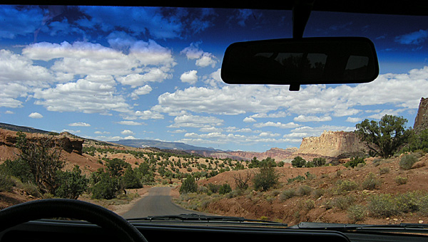
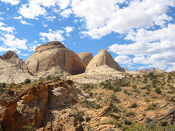
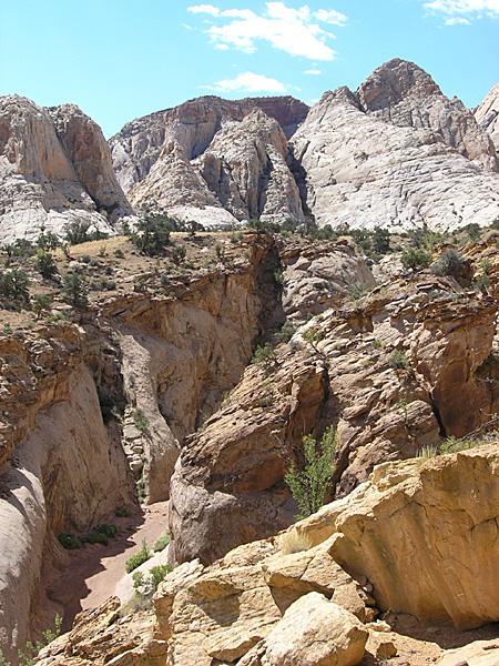
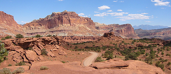
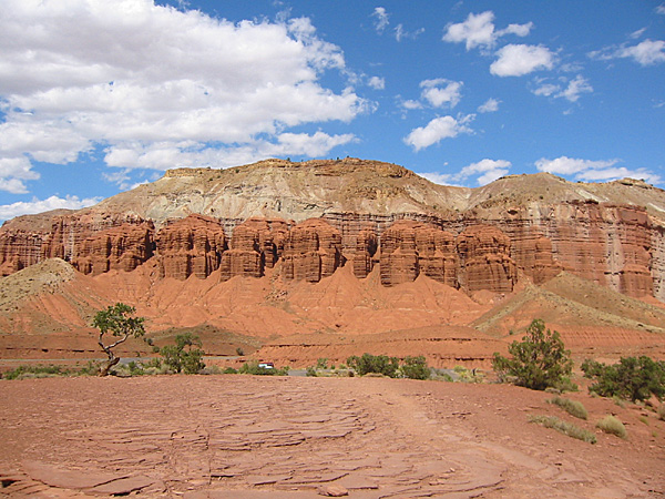
We left our cabin and headed for Capitol Reef National Park. The sky was clear and sunny, but windy and cool. Once again the Sun was at a low angle, so it was difficult to see some features until we headed south.
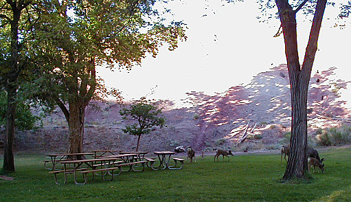
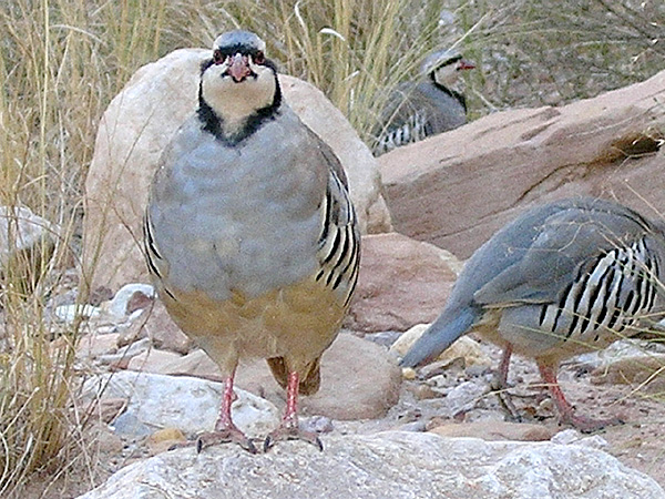
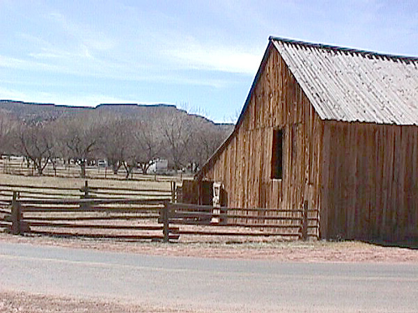
We stopped at the Park’s Visitor Center (elevation 5,400 feet), which was not open yet, then drove to the trailhead for Cohab Canyon. On the way we saw more than a dozen mule deer in the picnic area. Young males, females, and several fawns. We also saw a bunch of Chukar crossing the road near the barn.
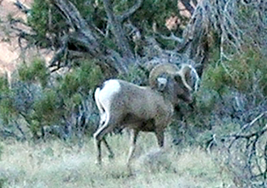
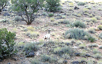
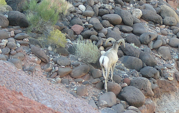
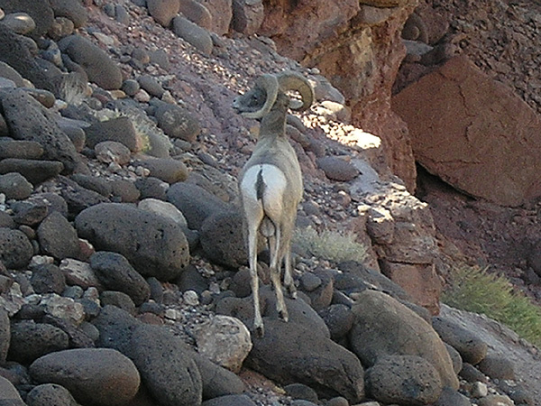
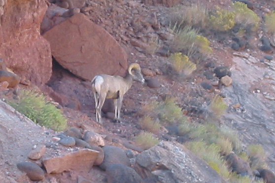
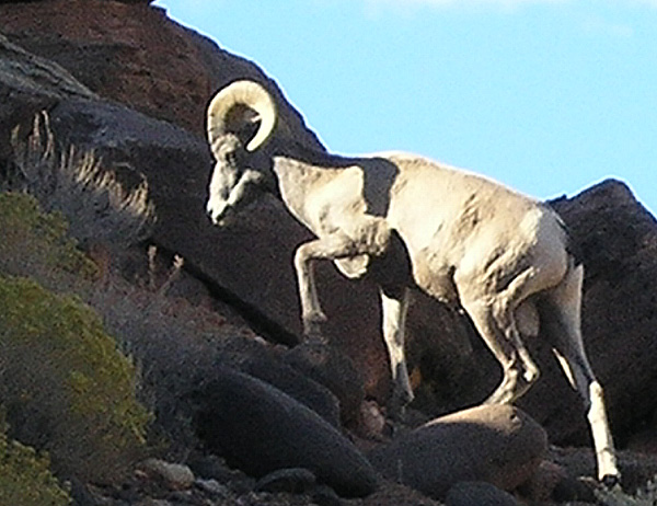
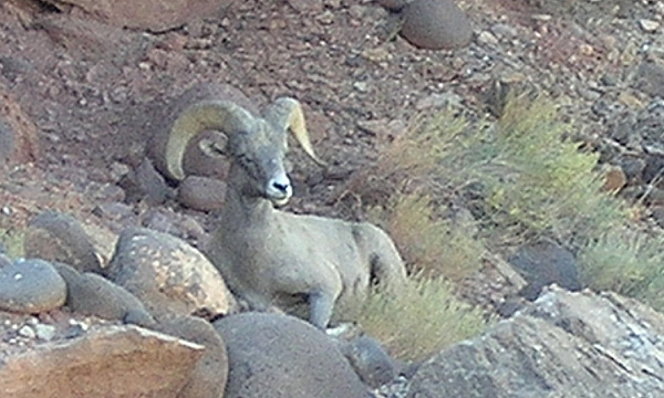
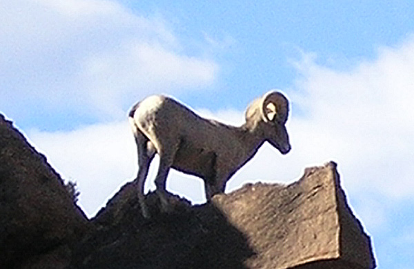
On the trail, on the way up, we stopped to use the binoculars to check out a rock that we thought might be a marmot. We heard a sound like a horse running down a rocky trail. When we looked up we saw a desert bighorn ram running down the trail, right at us. We moved to the side, but the ram finally saw us and stopped about twenty feet away, jumping onto a rock. He watched us for a few brief seconds, then casually made his way around and beneath us, to continue his journey on the other side. It all happened too fast that we were not able to get any good photos.
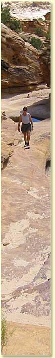
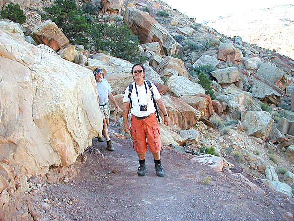
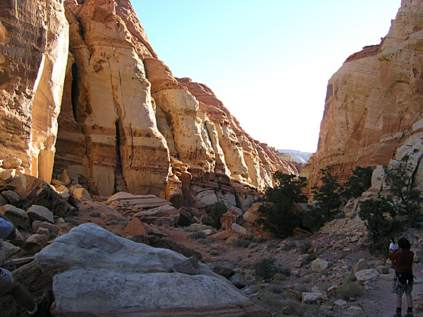
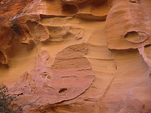
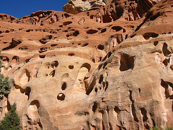
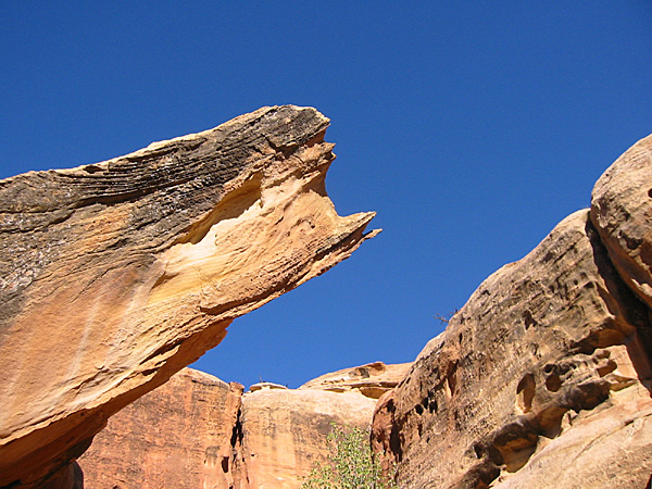
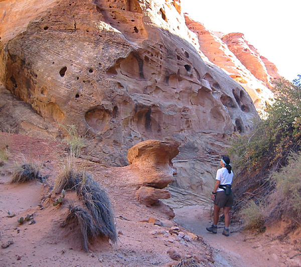
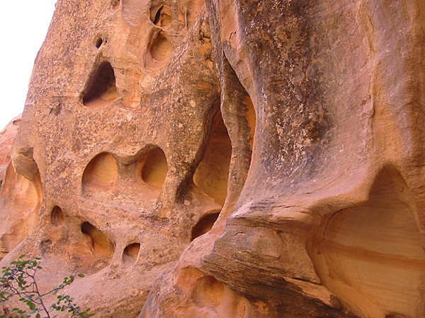
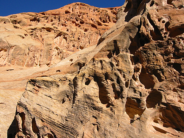
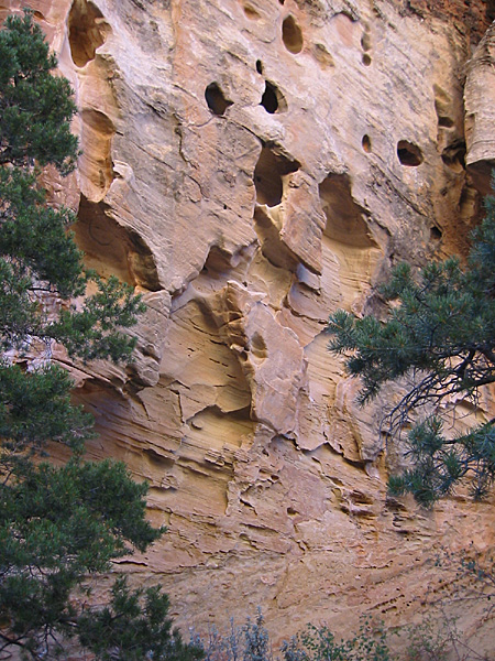
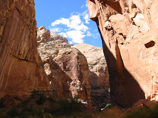
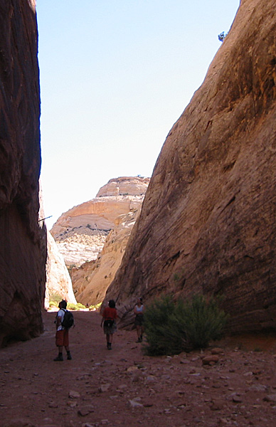
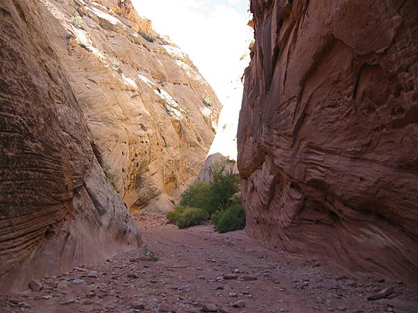
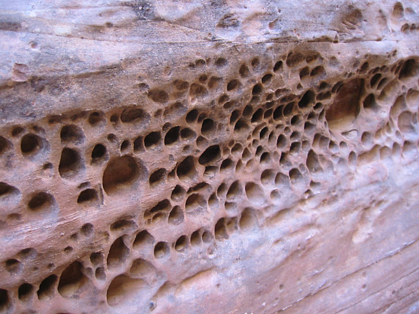
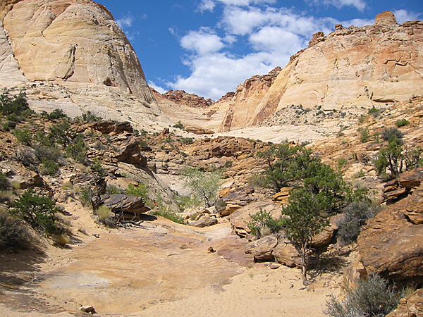
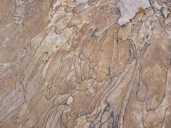
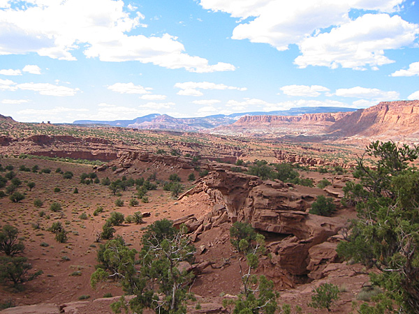
Inside the canyon we wandered along the trail, with Mirek and I taking many megabytes of photos with our digital cameras. We walked down to the point where the trail junctions with another trail that climbs above the ridge to an overview of the main parts of the Park. But we didn’t have time to take that route today, so we turned back. We stopped at a large tank full of water, but didn’t see anything in there but moss and other debris. We also took photos of the eroded sandstone with its pockmark holes, and a variety of subtle and not-so-subtle colors.
Cohab Canyon is one of my favorite locations, with enormous photo opportunities which change as the Sun moves across the sky, and the season. I always enjoy hiking in that canyon. In addition, it leads to a junction with the Frying Pan Trail, which leads to the south and eventually has a junction with the Cassidy Arch Trail above Grand Wash.
On the way out of the canyon, as we were making our way down the tight switchbacks, we ran across another ram. Probably the same guy as earlier. This time he was making his way back toward the mouth of the canyon. He passed very close in front of Anne, who was in the lead. This time he stopped across a narrow wash from us. We got several good shots of him as he grazed and settled down for a short rest. By the time we had gotten lower on the trail he was walking along the ridge line again, with the morning Sun giving us good light for a photo.
We also saw squirrels on the hike. By the time we came out, the temperature was warming, but still nice.
10:16 a.m.
We made it back to the Trooper. We talked to a foreign couple going up the trail, and told them to watch for the ram. I’m not sure they fully understood. Then we also talked to another couple who had just come down behind us, but they had not seen the ram and were disappointed. The fellow, like us, has done a lot of hiking and has never seen one. We have only seen a couple, and never this close.
10:24 a.m.
We stopped at the campground restrooms. The elevation there is 5,350 feet. We then headed south along the paved Scenic Drive.
 10:54 a.m. 10:54 a.m.
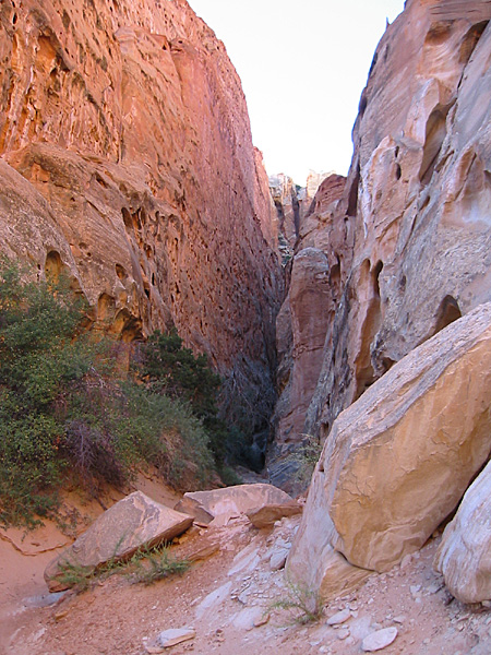
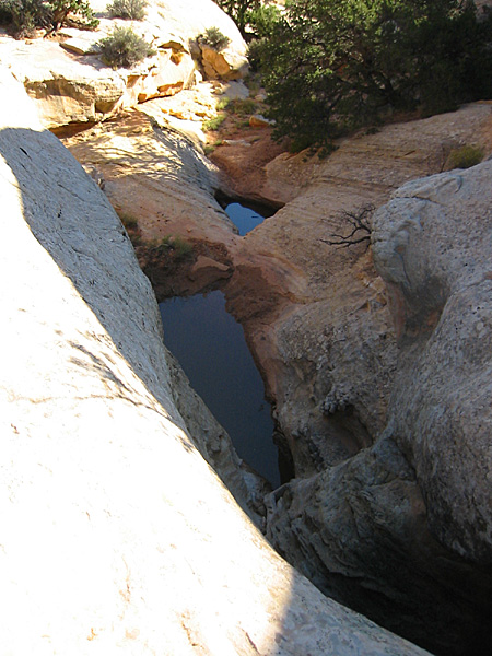
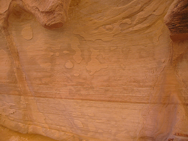
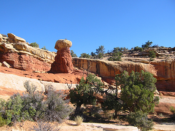
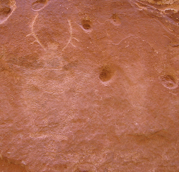
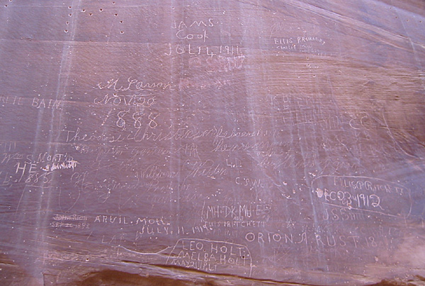
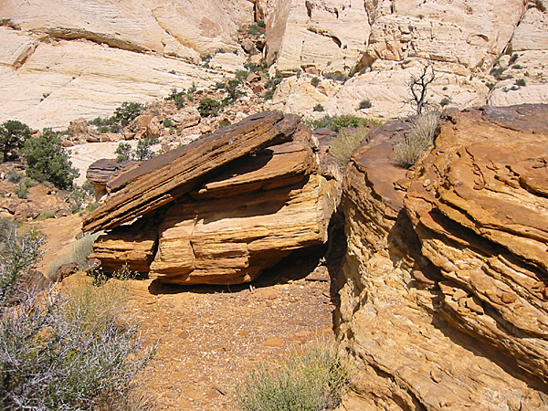
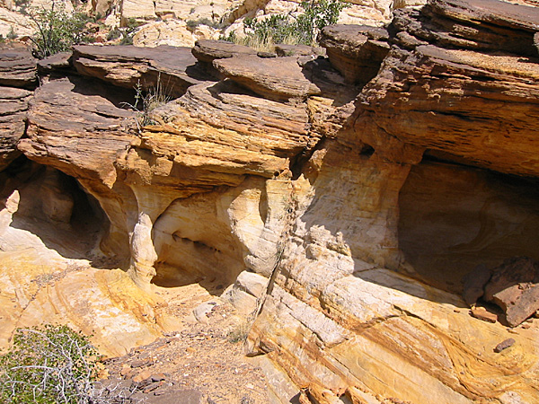
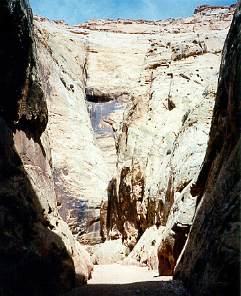
We saw Chukars at Capitol Gorge, near the parking area. We had driven down the dirt road into the wash, with its huge, towering sandstone cliffs rising above us. We left the Trooper in the parking area and walked .5 miles down the gorge. We saw lots of sandstone, pictographs, and the Pioneer Register, where there is historic graffiti. We continued on to The Tanks Trail, then hiked .2 miles up that side trail to The Tanks. There is a set of steep climbs, but it is not too bad, and the geology is pretty amazing along the way. There are some really spectacular photo opportunities.
The tanks are shallow to deep depressions in the sandstone where water collects after rain storms. Some of the pools had water, some did not. But the area is very impressive and there are some interesting geological formations. Then we hiked back out. By the time we made it back to the sandy wash of the gorge it was quite hot and we stayed in the shadows as much as we could on our way out. There was an occasional breeze which helped.
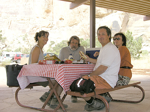
We ate lunch at the Capitol Gorge parking area. There is a large covered area with several picnic tables. The air was warm, but didn’t feel too bad when a breeze came through. There is also a vault toilet in this area.
12:55 p.m.
We left the Cathedral Gorge picnic area. There is 2.2 miles of dirt road from the Capitol Gorge parking area back to the paved road.
1:07 p.m.
We reached the paved road junction with Capitol Gorge (elevation 5,400 feet).
1:10 p.m.
We stopped at the Egyptian Temple turn-out.
1:28 p.m.
We entered the Grand Wash (elevation 5,400 feet) and drove the 1.2 miles of dirt road to the parking area, where we turned around. We did not stop. The temperature was getting to be too hot and the views were not that much different from Capitol Gorge.
1:44 p.m.
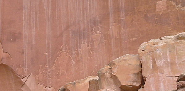
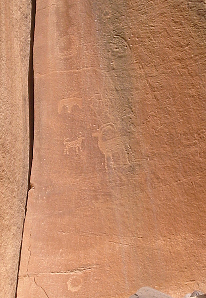
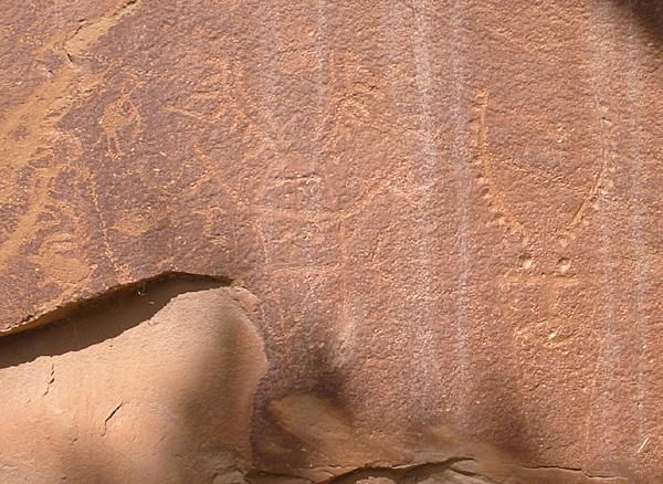
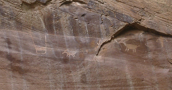
We stopped again at the Visitor Center to use the restrooms and to buy cold water and sodas. The we drove east along Highway 24 to see the petroglyphs.
 2:25 p.m. 2:25 p.m.
We finished our short walk to view the pictographs. The Park Service has built boardwalks along the cliff face. That’s a good way to keep the tourists from climbing up the cliff and defacing the artifacts. There are several panels of the ancient art work, but, because of the boardwalk, we were not able to get close enough for really great photos.
From there we turned back to the west on Highway 24.
2:36 p.m.
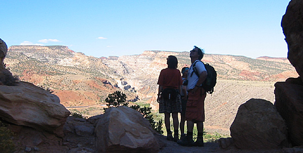
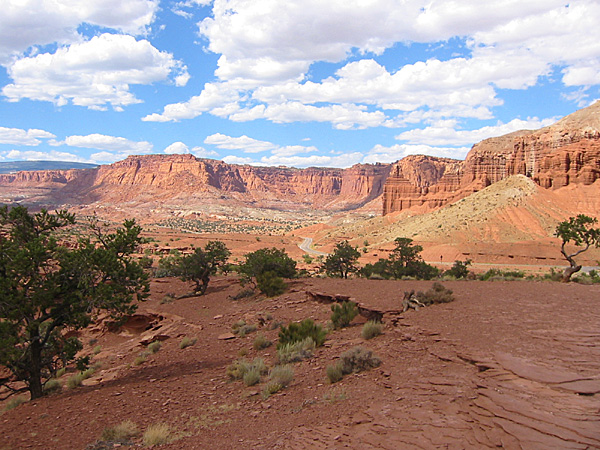
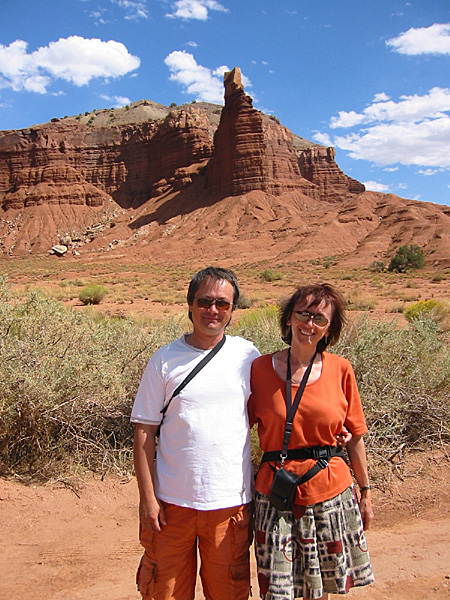
We drove out to Panorama Point and walked up to the viewpoint and took some photos and made some panoramic movies. It was windy, but the view was well worth the dust in the face. We decided not to drive out to the Goosenecks Overlook.
2:45 p.m.
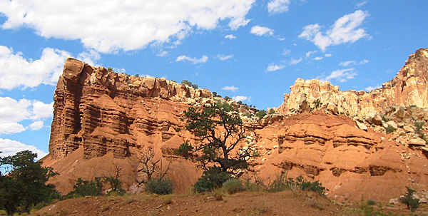
We drove across the road from Panorama Point and stopped at the Chimney Rock turn-out. We took more photos. It was hot and windy.
 2:58 p.m. 2:58 p.m.
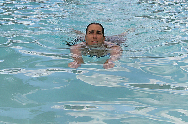
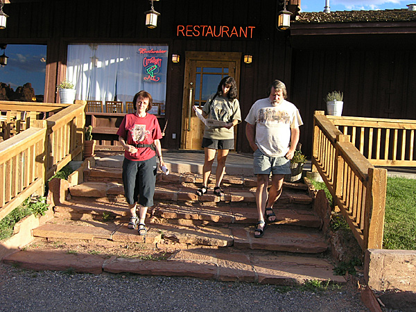
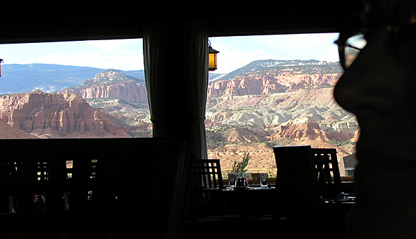
We got back to our motel in Torrey. Anne and I went swimming at the motel’s pool, and sat in the hot tub, while Mirek and Hana took their showers. After about an hour we went back to the cabin and took showers ourselves. Then we drove three miles east on Highway 24 to the Rim Rock Inn for dinner. This restaurant is in a wonderful setting, with red cliffs around two sides and views of the Aquarius Plateau around the other side. The food was good as well, and not too expensive, but not cheap, either.
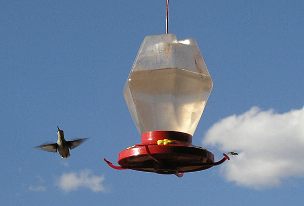
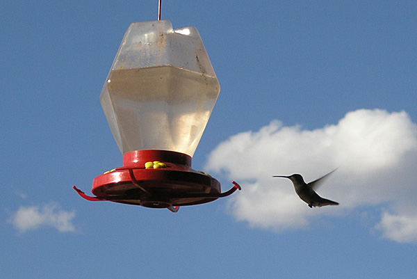
There was a hummingbird feeder outside one of the windows, and Mirek kept trying to get photos of the small birds, but every time he would walk up to the windows the birds would fly off. He finally did get a shot of a few of them.
Mirek and Hana had a salad. Anne had a sirloin steak. I had a chicken mole dish over rice. Mirek and Hana split pumpkin pie for dessert. I had pecan pie with a scoop of ice cream. Anne had berries with ice cream. We had wine with the dinner. Mirek and Hana had Bud because the restaurant had no bottled water. Anne and I paid $62.91 for our meal; Mirek and Hana paid $40.44 for theirs.
After dinner we drove back to our cabin and once again sat around on the patio talking until about 9:00 p.m., when we turned in. This was our last night on the road.
|