We were having problems with the air conditioner in the house. It was off when we arrived home yesterday. The fuse for the A/C in the main circuit box had flipped off. And it flipped off again over night. So we left it off and turned off the A/C and opened the windows slightly for the cats. The water heater had also let off excess pressure from the relief valve, getting all of the throw rugs in the storage room wet. So we turned down the hot water heater temperature even more.
6:00 a.m.
We have traveled 958 miles so far. We stopped at the local Maverick for breakfast. We bought muffins and coffee, which we ate on the road. The sky was clear and the air was cool.
We headed south on Interstate 15, through the cities of Orem and Provo, and past Utah Lake, to Spanish Fork, where we took Highway 6 east up Spanish Fork Canyon past the sight of the huge 1983 landslide that built a natural dam on Thistle Creek and eventually drowned the entire town of Thistle.
7:35 a.m.
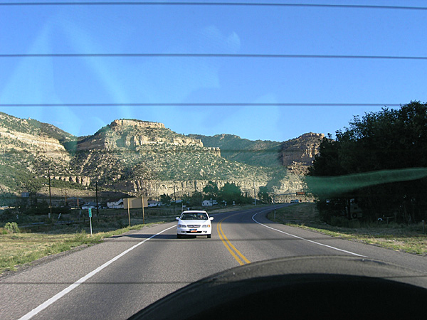
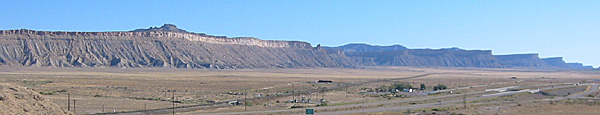
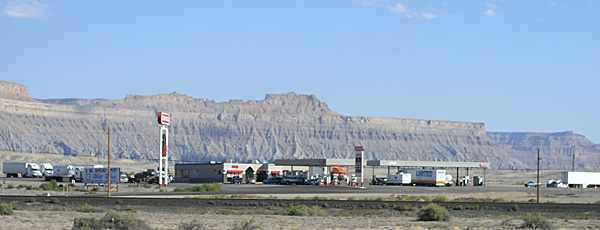
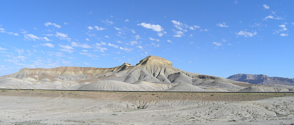
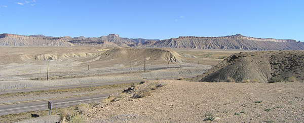
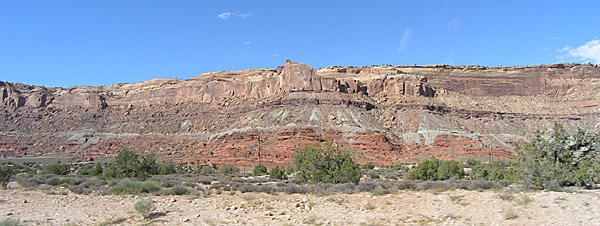
We stopped at the rest area on Highway 6, near Tucker, Utah. The air was cold. Then we continued east, and crossed Soldier Summit (elevation 7,440 feet) and then passed down the Price River Canyon and came out into the desert near Helper and Price. This is where we first encountered the Book Cliffs, which we rode beneath until we turned south at Crescent Junction on High 191 to Moab. The Book Cliffs continue on into Colorado and find their end somewhere east of Grand Junction. They are known as the longest continuous cliffs in North America.
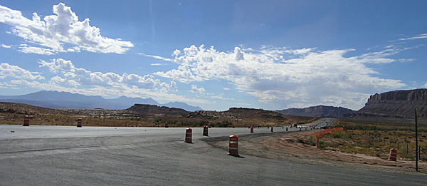
There was road work through Price, but it really didn’t slow us down much. In this area we also talked a bit about Butch Cassidy and his gang, and how Butch had grown up in a small Mormon community in Utah and had spent some time in this desolate part of the state. I told our guests about Butch and Sundance robbing the payroll train from Castle Dale, which is just down the road from here on Highway 10.
8:30 a.m.
We stopped in Wellington for gas and to clean the windows. We topped off the tank for $18.80. We also took the opportunity to make it a bathroom stop. While inside of the little convenience store I bought a can of bean dip to have with our corn chips for lunch, suspecting that our guests had never tried such a thing. We are 1,066 miles into the trip. The air was pleasantly cool.
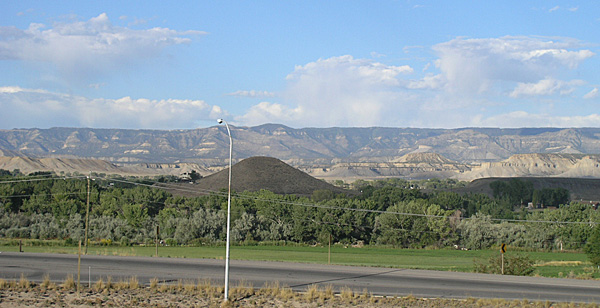
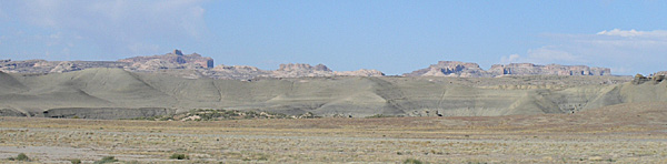
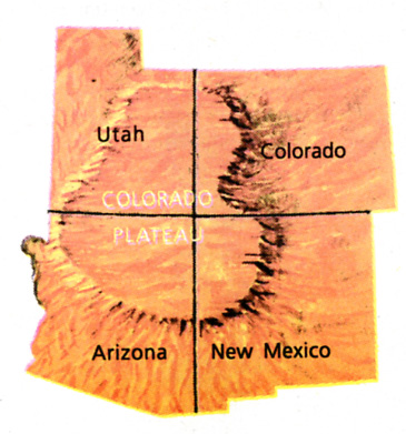
From Wellington we continued on southeast on Highways 6 and 191 to Green River, where we picked up Interstate 70 east. On this stretch of the drive I was able to point out some features of the San Raphael Swell and the Henry Mountains to the south. We could also see the La Sal Mountains above Moab, our day’s destination. I noted that we would see the Henry Mountains on almost every day for the rest of our trip, as we essentially circumnavigate them while we drive along the edge of the Colorado Plateau. After we headed east on Interstate 70 we crossed the Green River again, which we had first crossed as a narrow stream in western Wyoming the day before.
10:00 a.m.
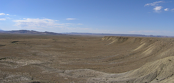
Near Crescent Junction we stopped at the I-70 rest area. We are at 1,139 miles into our journey. There are clean bathrooms, drinking water, and shaded picnic tables here, with some very nice views of the surrounding desert and the Book Cliffs. We looked around and took many photos. Mirek was excited by the open space, the clear blue sky, and the expanse of desert.
10:34 a.m.
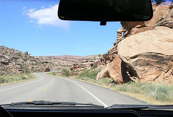
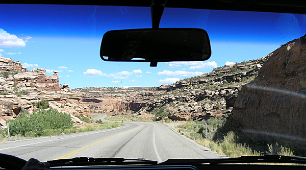
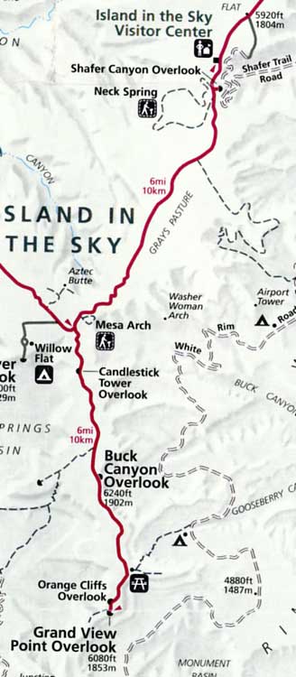
Just past the rest area, at Crescent Junction, we turned south on Highway 191 and headed toward Canyonlands, Arches, and Moab. About eight miles north of Moab we turned west on Highway 313 and headed up Sevenmile Canyon toward the Island in the Sky District of Canyonlands National Park. (See map.)
10:50 a.m.
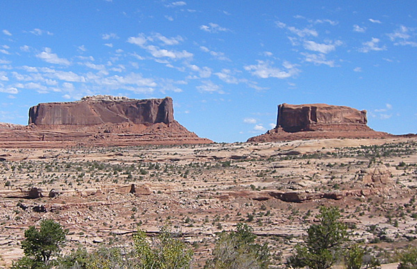
We stopped at a several view points along the road. First to see the Monitor and the Merrimac, two buttes that are named after the Civil War ships with similar names. We took a short .25 mile loop walk among the rocks along a marked trail. The day was already warming up.
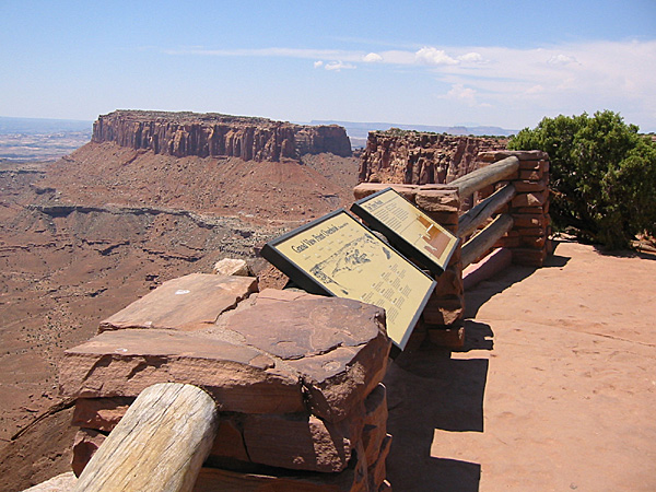
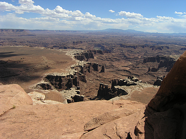
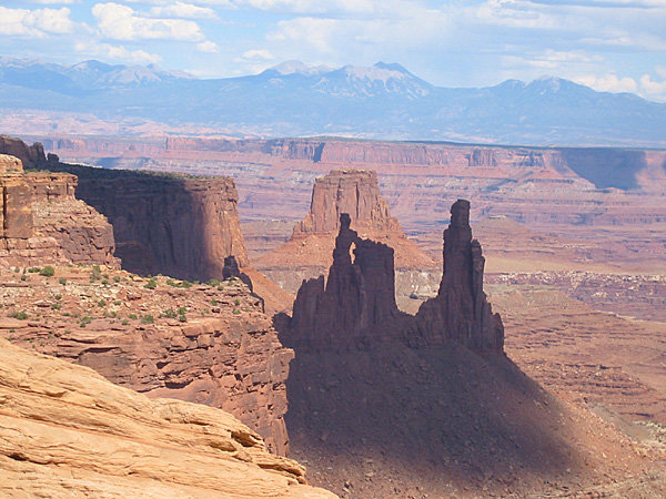
Then we stopped at another view point that looked out toward the east, over the canyons with the La Sal Mountains as a backdrop. From there we drove south and entered Canyonlands National Park. We continued on without stopping toward Grand View Point.
11:30 a.m.
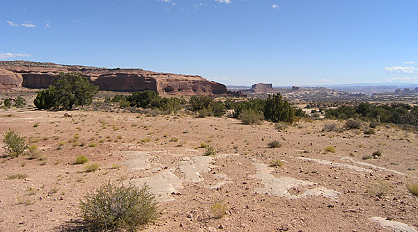
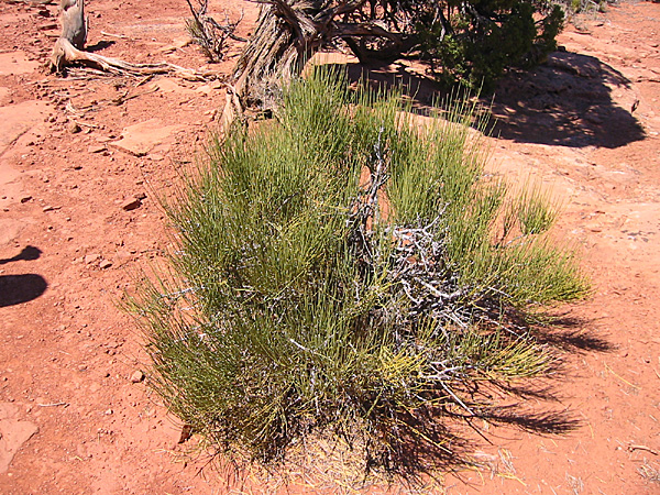
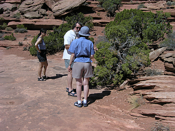
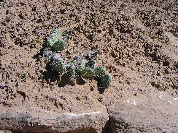
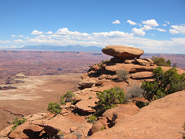
We visited Grand View Point Overlook (elevation 6,080 feet, or 1,853 meters) and walked out along the rim trail about .25 miles. We wore our Tivas. The sun was beginning to get hot. We didn’t make it all the way to the end, but spent quite a bit of time looking at the geology, the views, and some of the local plants, like ephedra (Mormon Tea), junipers (Western Cedar), pinyon, prickly pear cactus, lichen, and sage. We also showed Mirek and Hana the cryptobiotic soils, explaining that even though they looked like small piles of black dirt we must be careful not to step on them because they are actually living organisms, and are very important to the ecology of the desert.
There were a few tourists at the overlook, but the atmosphere was quiet and casual. A Park Ranger was also giving a lecture on the local geology.
12:30 p.m.
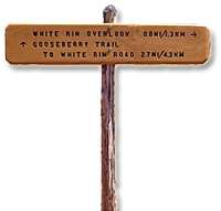
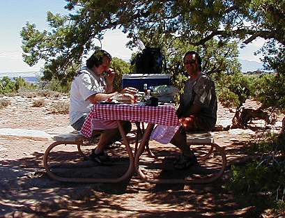
We drove north a short ways to the Gooseberry picnic area for lunch. We found a table under a juniper that was in the shade. The air temp was pretty warm, moving toward hot. There were a few gnats flying around, and I ended up with three bites on my right leg.
 1:36 p.m. 1:36 p.m.
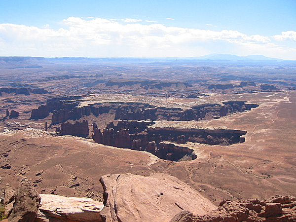
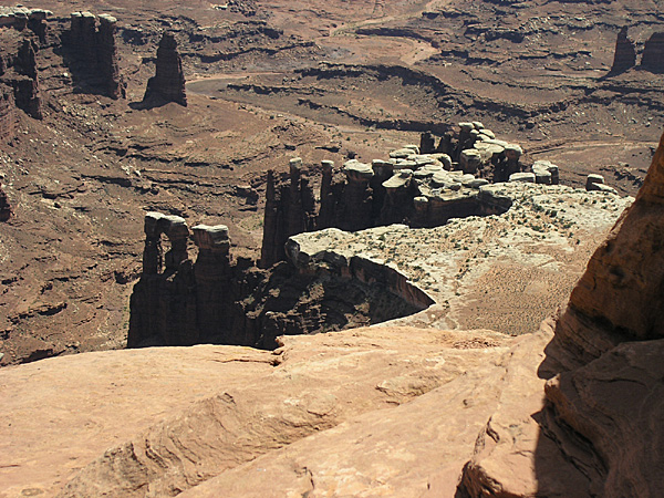
After lunch we hiked the White Rim Overlook Trail, .75 miles one-way. It was pretty hot along the way, but the views were excellent; some of my favorite in the Island in the Sky District. The view of the White Rim below is especially exciting in the morning light because of the angle of the Sun and the way the shadows fall across the landscape and highlight the white capped towers against the dark chocolate and rust browns of the surrounding formations.
We saw a few small lizards, more cactus, and took a photo of a newlywed couple out on the point.
2:52 p.m.
We got back to the Trooper, used the picnic area restroom one more time, then headed out, back toward the south about a mile.
 3:00 p.m. 3:00 p.m.
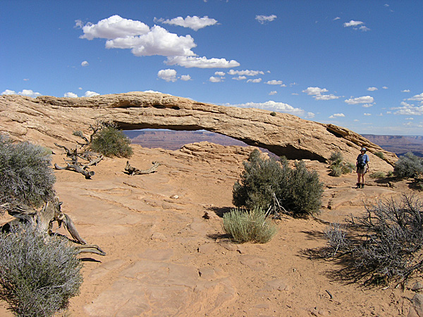
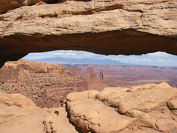
We stopped at the Orange Cliffs Overlook, between Gooseberry and Grandview. It looks west. From there we drove north again and stopped at Mesa Arch (the photo for the banner at the top of this page was taken at Mesa Arch). We walked the .5 mile loop trail to the arch and its spectacular view. This is one of the more unique photo opportunities within this part of the Park. Along the trail Anne scolded two young oriental girls who were wandering off of the marked trail They kept walking off into the cryptobiotic soils.
There were a few people along the trail and at the arch, but it was not crowded.
3:52 p.m.
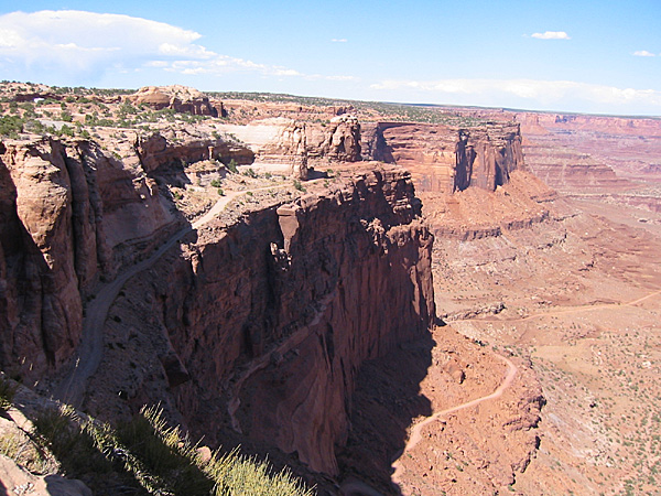
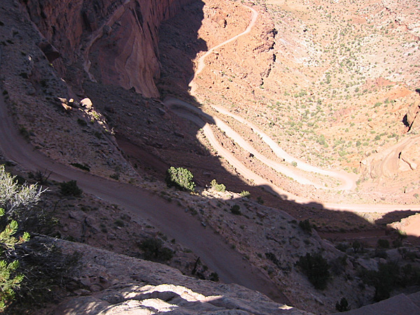
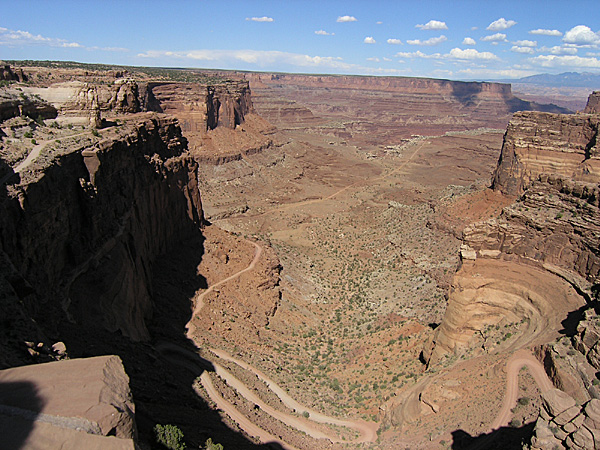
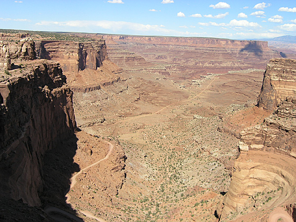
We got back into the Trooper and continued on north to the Shafer Canyon Overlook, where we could see the switchbacks of the Shafer Trail as it winds up the head of the canyon to meet up with Highway 313. From here we could see the junction of the Shafer Trail with the White Rim Trail and Potash Road.
4:30 p.m.
We stopped at the Visitor Center for water and to use the restrooms. Hana bought a packet of Canyonlands post cards and we looked at several of the exhibits of local animals. We then headed north out of the Park, back along Highway 313 to its junction with Highway 191. There we headed south, and drove past the entrance to Arches National Park.
5:04 p.m.
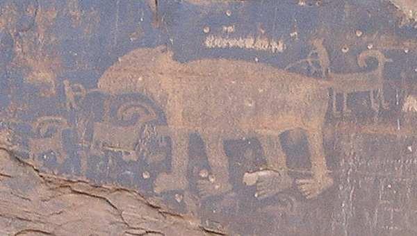
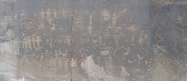
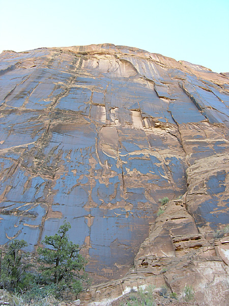
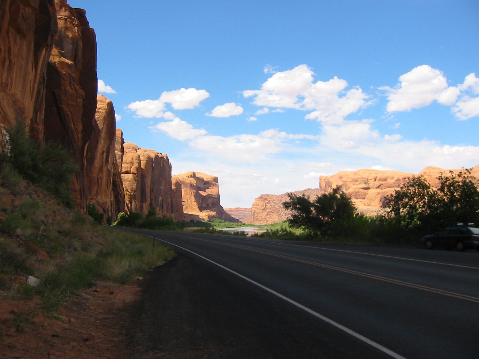
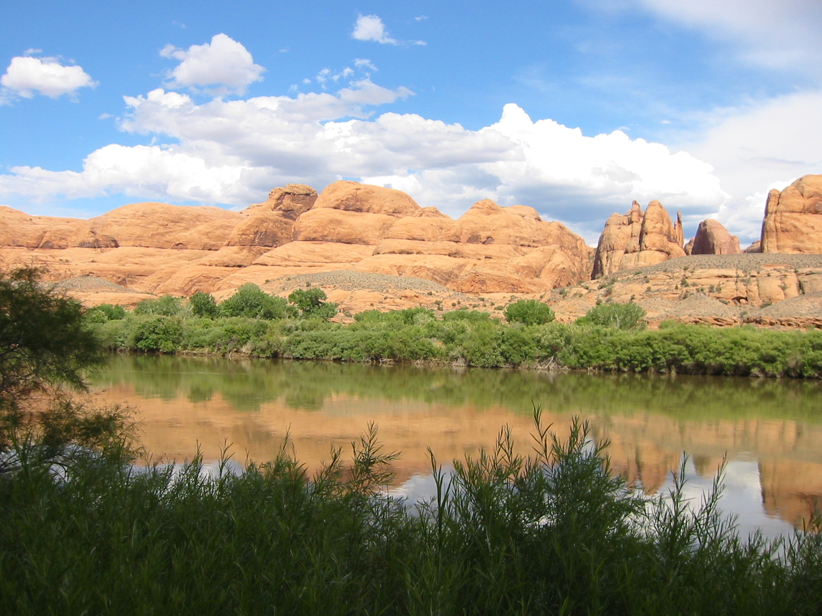
Just north of the bridge over the Colorado River we took Highway 279 west. Locally this is known as Potash Road (which eventually connects to the Shafer and White Rim Trails). We drove just a short ways up the road to see the bear pictograph and a few others. There were several groups preparing to climb the cliff faces. Mirek and Hana were amazed by the shear cliffs of Navajo sandstone rising sharply from the banks of the Colorado River.
We then reversed our course and headed back toward Moab.
5:45 p.m.
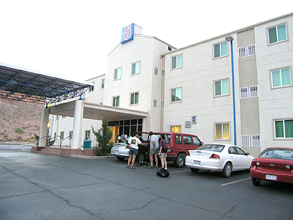
We reached Moab and checked in to the Motel 6 on the northern edge of town. Each room cost us $60.60 per night. We used carts and the elevator to haul our luggage up to the third floor. Our rooms were across from each other, at the end of the hall. Neither of us had a great view, but Mirek and Hana’s window overlooked the swimming pool.
 7:00 p.m. 7:00 p.m.
We cleaned up and had dinner at the Moab Brewery. Hana and Mirek ordered the local pilsner, but the waitress brought Hana a beer like I had ordered instead. We had to get the waitress to correct that. Anne ordered a very dark beer, but I don’t recall the name.
I had a chili verde burrito; Anne had a BBQ chicken sandwich; Mirek and Hana split a margarita chicken plate. I ordered the spicy cheese fries as an appetizer (one of my favorite dishes in Moab). Mirek and Hana tried them, but did not like them. I think they were too spicy and hot. The room was noisy, and there were some squalling babies whose screeches cut through the room like a searing beam of sunlight. Anne and I paid $32.80 for our meal; Mirek and Hana paid $26.80 for theirs.
9:00 p.m.
We finished our meals and headed back to Motel 6. The evening air was cool. We’d had another busy day, so we turned in.
|


